|
A Dutch account of Liberia in the Seventeenth Century: Chevalier des Marchais |
||||||
|
|
|
||||||
|
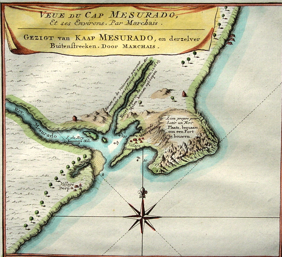
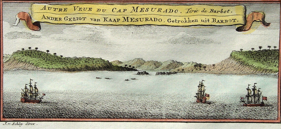
The journey to Cape Mesurado “Almost every vessel, after leaving Cape Mount, touches at Cape Mesurado. They are obliged to call at this last cape for wood and water, to serve them while they remain at the factory at Fida (Hwida1), where the water is indifferent and difficult of access. Another reason is that the natives of Fida, looking upon trees of every kind as species of divinities, will neither cut them down themselves nor allow other people to do so. In the third place, rice, maize, or Indian corn, fowls, sheep, goats, and even oxen are in greater plenty at Mesurado than at Fida. “The course from Cape Mount to Cape Mesurado is south-east; the distance eighteen leagues. The coast is clear, and the anchorage is everywhere good. If the wind be contrary it will be proper to anchor; if there be a calm, for security against the currents, you must also put out your anchor.” Chevalier des Marchais, owing to contrary winds, took six days to make this short passage of fifty-four miles. On December 9th, 1724, he anchored a mile and a half from Cape Mesurado. A canoe immediately came off to him. He was heartily welcomed by the natives, whom he had visited on a previous occasion on the affairs of the Royal Senegal Company. The “king,” being informed of his arrival, sent his Prime Minister to invite him on shore, and accordingly he landed the next morning. Description of the area
|
1 Otherwise “Whydah” in Dahome.
|
||||||
|
|
|||||||
| © fpm van der kraaij |